Profile
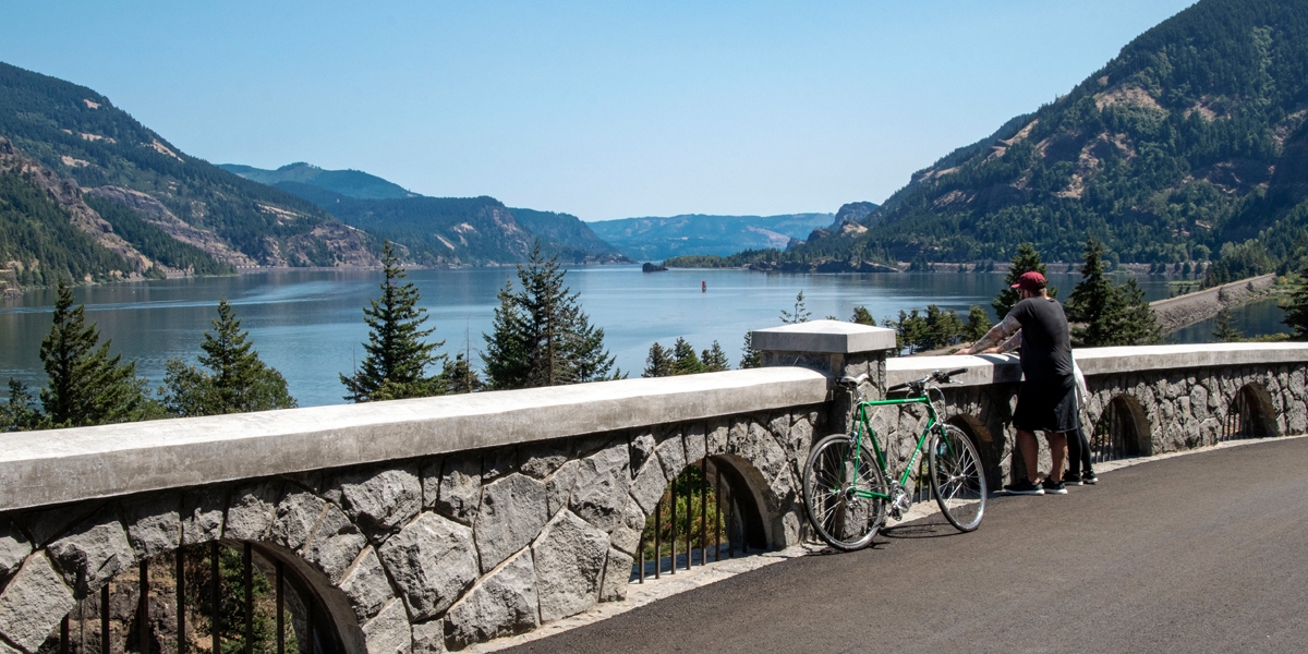
Wyeth Trailhead provides access to over 5 miles along the paved Historic Columbia River Highway State Trail. It’s also the start of the U.S. Forest Service’s Wyeth Trail (#411). The trailhead — located on the Historic Columbia River Highway (Hwy 30) just west of Wyeth Campground — has parking, a water filling station and a vault toilet.
Heading east on the state trail, hikers and bikers will pass three waterfalls, amazing views of the Gorge, and trail access to the US Forest Service’s Mount Defiance Trail (#413) and Starvation Ridge Trail (#414).
After the first mile, visitors cross a talus slope at Shellrock Mountain, where fences offer protection from falling rocks. From here the trail climbs east up the Summit Creek Viaduct to the “Mossy Road,” a section of the historic highway that became draped in moss after the highway was abandoned. Visitors will emerge from the forest to see an impressive view of the Gorge.
Next, the trail passes views of Lancaster Falls, Hole-in-the-Wall Falls and Cabin Creek Falls before reaching Starvation Creek Falls at the 4.6-mile mark. A restroom and picnic tables make this the perfect stop for a lunch break. The final mile ends at Viento State Park.
For information, see our Historic Columbia River Highway State Trail bicycle and hiking map.
Know Before You Go
- Dogs are allowed on the Historic Columbia River Highway State Trail, but must be on a leash no longer than 6 feet at all times.
- E-bikes are allowed on the state trail. The following devices are not allowed: electric scooters, mountain boards, electric unicycles, and other similar devices. For more information, please call Viento State Park at 541-374-8811.

Map
Sorry, no records were found. Please adjust your search criteria and try again.
Sorry, unable to load the Maps API.