Profile
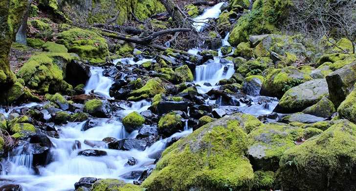
Zooming eastbound down Interstate 84, you might very well miss this tiny park. Nestled at the base of the sheer walls of the Columbia Gorge, the park’s namesake Starvation Creek Waterfall is just over a boardwalk, 50 feet from the parking area. Picnic tables feature views of the falls.
This park is also a trailhead for the paved Historic Columbia River Highway State Trail that traces the original historic highway. Heading east, take the wide, paved path 1 mile along a remnant of the the historic highway to Viento State Park. This section of trail travels through thick fir forests and lush undergrowth—moss often carpets portions of the paved trail. When the forest breaks, look for views across the Columbia River into Washington.
Hikers and bikers can also head west 4.6 miles to Wyeth Campground and trailhead, passing Cabin Creek Falls, Hole-in-the-Wall Falls and Lancaster Falls before climbing to an impressive view of the Gorge. From here, the visitors cross into the forested "Mossy Road," a section of the historic highway that became draped in moss after the highway was abandoned. The final section crosses a talus slope at Shellrock Mountain, where fences offer protection from falling rocks.
Near Hole-in-the Wall Falls, hikers will find the trailhead for Mount Defiance Trail (#413).
For trail information, see our Historic Columbia River Highway State Trail bicycle and hiking map.
Know Before You Go
- Dogs are allowed on trails, but must be on a leash no longer than 6 feet at all times.
- E-bikes are allowed on the Historic Columbia River Highway State Trail. The following devices are not allowed: electric scooters, mountain boards, electric unicycles, and other similar devices. For more information, please call Viento State Park at 541-374-8811.
Map
Sorry, no records were found. Please adjust your search criteria and try again.
Sorry, unable to load the Maps API.